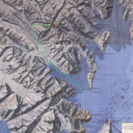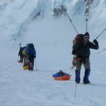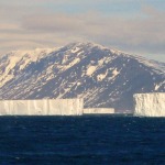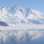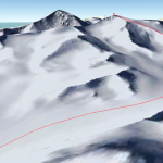
Getting to Mt Bevin is pretty easy. Start at Invercargill in southern New Zealand and take a 3,000 km boat journey south along the 170° line of longitude until you reach Cape Adare, and from there continue just a little further south into Moubray Bay. Once off the boat and on the ice, just head up Ironside Glacier for 40 kms or so, and just before the end of the glacier turn right where Mt Bevin should be visible up the valley. If ice and weather conditions are favorable, then the summit of Mt Bevin will be only a few more days climb away. Probably worth mentioning that the crevasses on Ironsi...
More
Author: stephen
Historical Expeditions around Robertson Bay
Between Cape Adare and Cape Barrow lies Robertson Bay, the place where early Antarctic explorers spent considerable time. It also happens to be one of the possible starting points for the Mt Bevin Expedition team.
Sailing directly from New Zealand to Antarctica, you most likely would arrive at Cape Adare and Roberston Bay. And this is what some of the early Antarctic explorers did.
The first undisputed landing on the Antarctic Continent was by the men of the Antarctic whaling ship. On the 24th of January 1895 conditions permitted a whaling boat to be lowered and 6 men where able to land ...
More
Route up Ironside Glacier
The most direct route from Moubray Bay to Mt Bevin is up Ironside Glacier. A possible route marked in green is shown on the map below. This example route is just over 50 kms in length.
A little research has indicated that this route may not be feasible. This is based on information gained during the 1967 Expedition led by Sir Edmund Hillary in the Cape Hallett region . One of the stated objectives of the expedition was:
To manhaul up the Ironsides (sic) Glacier and carry out a geological and mapping programme under the direction of a leading geologist and an experienced cartographer, both ...
More
A Little Light Reading?
A short list of books that have helped inspire and prepare us for the expedition. These books are wonderful and really bring to live the perils, history and opportunities for explorers and mountaineers planning expeditions to the region. Also provided is a list of reading material available on the Internet.
The Loneliest Mountain
The dramatic story of the first expedition to climb to the summit of Mt Minto. Greg Mortimer led a small team of adventurous mountaineers across the perils of the Southern Ocean in a tiny sailing boat, up the mighty Tucker Glacier without motorized transport a...
More
Just how hard is it to climb Mt Bevin?
Climbing Mt Bevin, or any mountain in Antarctica, is a serious undertaking. The climb itself is expected to be moderate in terms of technical challenge, but the remoteness of the mountain and the climate of Antarctica add a layer of complexity. People often ask how hard will the climb be? No one has ever been there, so it is hard to really know. Here is our best guess.
The logistics of getting to the mountain and back again safely are somewhat complex. The ice-condition at the time and the judgement of the Ship's Captain will determine the insertion point and ultimately the route taken. Two...
More
New Logo
Ros Bevin (niece of our Patron) has kindly agreed to create a logo for the expedition. And every good expedition needs a logo.
More
Facebook Page
The Mt Bevin Facebook page is now live. There is not much content or news on it just yet, but it feels really good to have the page established. Over the next few years we will update our Facebook page will all of the goings-on. So, please follow along with us on Facebook.
More