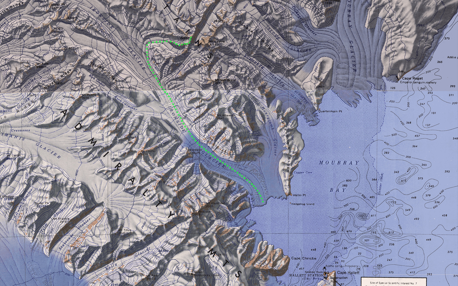
The most direct route from Moubray Bay to Mt Bevin is up Ironside Glacier. A possible route marked in green is shown on the map below. This example route is just over 50 kms in length.
A little research has indicated that this route may not be feasible. This is based on information gained during the 1967 Expedition led by Sir Edmund Hillary in the Cape Hallett region . One of the stated objectives of the expedition was:
To manhaul up the Ironsides (sic) Glacier and carry out a geological and mapping programme under the direction of a leading geologist and an experienced cartographer, both men with extensive mountaineering experience.[1]
The report from the team after the expedition noted that:
The planned scientific programme on the lronside Glacier (72°08’S, 169° 40’E) which flows into Moubray Bay between the parallel ridges trending W.N.W. from Mt. Herschel and Mt. Sabine, was abandoned. A member of the party states that inspection showed the lower part of the glacier to be “impossible”: crevasses and icefalls made it a veritable “hell of ice”.[2]
The Mt Minto expedition in 1988 came to a similar conclusion.
Crevasse fields and ice fields bar access up the Ironside Glacier to Mt Minto […] which means we have to approach from behind.[3]
The USGS reconnaissance map shows significant ice crevasses. Finally, viewing the route on Google Earth also indicates that the route is heavily crevassed. Further investigation of this route is definitively required.
References
[1] Antarctic, published quarterly by the New Zealand Antarctic Society, Vol. 4, No. 10, June, 1967, Page 491
[2] Antarctic, published quarterly by the New Zealand Antarctic Society, Vol. 4, No. 12, December, 1967, Page 596.
[3] The Loneliest Mountain: The Dramatic Story of the First Expedition to Climb Mt Minto, Antarctica, by Lincoln Hall, ISBN 0-89886-22-1, Page 73